- Success Stories
- Environmental Resource Assessment & Management
Developing a Stream Assessment Protocol
CSS has been a significant contributor to the development and implementation of the Oregon Stream Function Assessment Method (SFAM) for more than 10 years. SFAM is a key component of the Oregon Stream Mitigation Program administered by the Oregon Department of State Lands.
The mitigation program is designed to address damage to aquatic resources caused by permitted activities, such as road construction, and commercial building. CSS employee owners have provided support for method development including field trials, data analysis, and expertise in developing the Excel-based stream assessment scoring tool. In addition, CSS employee owners helped write the SFAM Manual and Scientific Rational support document. Visit Oregon Department of State Lands website to learn more about this program.

See More CSS Insights
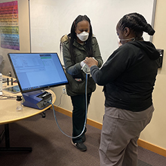
Safety Support To First Responders
First responders put their lives on the line to help others, and our team helps safeguard their protection. Our team on contract with the National Institutes of Health (NIH) Respiratory Protection Program works with staff to test respirators and establish secure fits. Similarly, they provide these fit tests for fire department personnel on a regular…
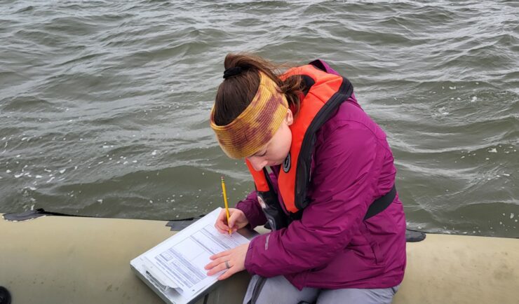
Organizing Teams to Monitor Coastal Contaminants
For nearly 40 years NOAA’s National Mussel Watch Program has been monitoring contaminants in coastal waters in over 400 sites around the U.S. by testing sediment and bivalves, such as oysters and mussels. A CSS employee owner organizes and coordinates the regional missions to collect and test samples. This includes developing a schedule and coordinating…
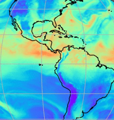
Evaluating the Use of Earth Observations Digital Twin Technologies
Earth Observations Digital Twin technologies are data analytics, artificial intelligence, and advanced modeling technologies that provide an estimate of the true state of the Earth. An Earth Systems Digital Twin is observations-based and grid-flexible with multiple components and high-resolution data over space and time to capture all available observations and feed a variety of direct…