- Uncategorized
- Environmental Resource Assessment & Management
Supporting Wetlands Today and Throughout the Year
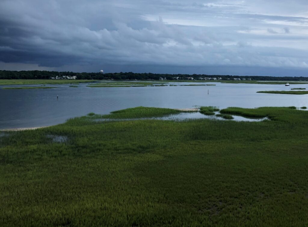
February 2 is World Wetlands Day, a day to celebrate and honor these invaluable ecosystems. Through a variety of projects on several contracts, our employee owners support wetlands throughout the year. Below are some examples of projects that CSS works on to support wetlands and promote the benefits they provide.
- National Wetland Condition Assessment. Our employee owners have supported research in wetland biogeochemistry and ecology for over two decades through our contract with the U.S. Environmental Protection Agency Pacific Ecological Systems Division in Corvallis, Oregon. Much of this work has been associated with National Wetland Condition Assessment as part of the EPA National Aquatic Resources Surveys. CSS staff helped develop field protocols, analyze water samples, and conducted field surveys.
- Field Studies. Through our contract with NOAA’s National Centers for Coastal Ocean Science, we have supported many projects related to wetlands around the country, including monitoring and assessing wetland restoration projects, using unoccupied aircraft systems to monitor wetlands, ecological assessments, economic valuation of wetlands for shoreline protection, and many more. Our scientists work in the field along with NOAA scientists to study and collect data that will be useful to coastal communities and decision-makers.
- National Estuarine Research Reserve System. Our employee owners primarily serve as coastal management technical experts and liaisons between the national estuarine research reserves and NOAA’s Office for Coastal Management (the agency that manages the system in partnership with state agencies, academic institutions, or non-profit organizations). The estuarine reserve system protects nearly 1.4 million acres of estuarine, wetland, riverine, forest, and open water environment.
- Data and Tools. Through the contract with NOAA’s Office for Coastal Management, our staff develop and manage data, tools, and training that help coastal managers understand the benefits of wetlands. These products include Land Cover Data, Sea Level Rise Viewer, Coastal County Snapshots – Wetland Benefits, and the Coastal Flood Exposure Mapper.


See More CSS Insights
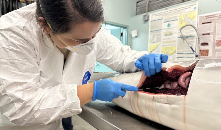
Assisting South Carolina Marine Mammal Stranding Network
CSS employee owner and Marine Mammal Microplastic Specialist supporting NOAA’s National Centers for Coastal Ocean Science assists the South Carolina Marine Mammal Stranding Network in responding to dead marine mammals when they strand on beaches or estuaries throughout South Carolina. This is work is critical for human and environmental health because it provides invaluable samples…
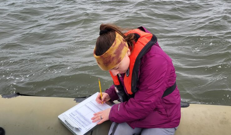
Organizing Teams to Monitor Coastal Contaminants
For nearly 40 years NOAA’s National Mussel Watch Program has been monitoring contaminants in coastal waters in over 400 sites around the U.S. by testing sediment and bivalves, such as oysters and mussels. A CSS employee owner organizes and coordinates the regional missions to collect and test samples. This includes developing a schedule and coordinating…

Overcoming COVID-19 Challenges
Great job to our team supporting our contract with the U.S. General Services Administration on assisting the client with conducting a year’s worth of environmental, health, and safety surveys in just six months! Due to limitations with COVID-19, the team was unable to conduct their surveys on their usual timeline and instead had to work…